Navigating the concrete jungle has never been easy. Every year, countless brave souls venture into the labyrinth of city streets only to get lost in the ceaseless hustle and bustle. You are not alone in this predicament. The root of the problem? Subway lines.
Confusing maps, cryptic signs, and a mesh of intersecting routes weave a maze that feels impossible to decipher. Your heart races as you rush to make that last-minute change at the junction, only to find yourself on a train heading in the exact opposite direction.
This comprehensive guide doesn’t just acquaint you with Subway Lines; it teaches you to harness their power, to bend the urban landscape to your will. From the pulsating heart of New York’s subway to the intricate veins of Tokyo Metro, the lyrical labyrinth of London’s Underground, and beyond – we have you covered.
Table of Contents
Decoding Subway Maps: The Basics
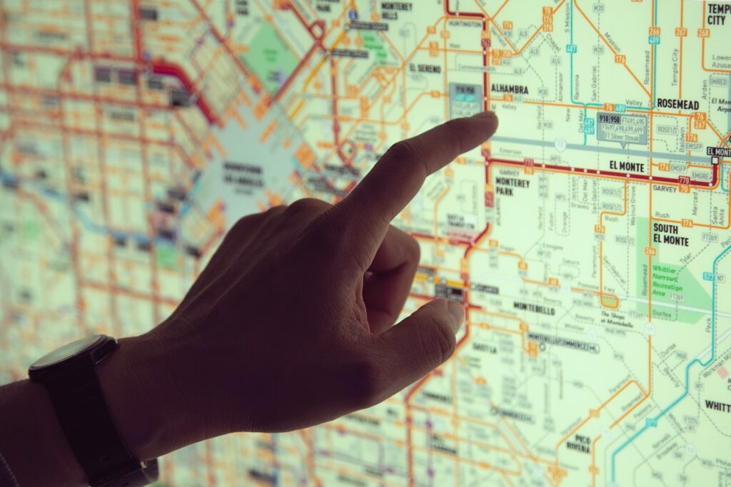
Subway maps are much more than a kaleidoscope of colored lines crisscrossing on a piece of paper. They are visual representations of intricate transit systems, guiding millions of commuters through the urban labyrinth. Mastering these maps is crucial to navigating cities with ease and confidence.
1. The Symbology of Colors and Lines
At the heart of every subway map lies a myriad of colorful lines, each representing a different route or service. Often, these colors are not random but have been selected with care for their visibility and contrast. Learning to distinguish between these colors is the first step in deciphering a subway map.
2. Stations and Interchanges
Subway maps employ various symbols to denote stations and interchanges. Circles, squares, or other geometric shapes often represent stations, with their names labeled alongside. Interchanges, where multiple lines intersect, are typically marked with a distinctive symbol or a combination of symbols. These could be larger circles or overlaid squares, sometimes filled with multiple colors representing the intersecting lines.
3. The Grid System and Geographic References
While most subway maps use a schematic design that doesn’t strictly adhere to geographical accuracy, some do integrate elements of the city’s layout, such as key landmarks, rivers, or coastlines. These references can help orientate the user within the city.
4. Zones and Ticketing Information
In many subway systems, zones are marked on the map to indicate fare divisions. These zones can play a crucial role in determining the cost of your journey. In addition, maps often include symbols to indicate ticket vending machines, information centers, and other amenities.
5. Understanding the Legend
Every subway map comes with a legend or key, which is essential to understanding the symbols and markings on the map. This could include explanations for different line styles (solid, dashed, dotted), which may represent types of service, such as express or local trains.
6. Route Directions and Timings
Lastly, subway maps often include indicators for the direction of travel, usually marked by arrows alongside the lines or terminus station names. Some maps may also provide information about service frequency and operation hours, helping you plan your journey better.
Decoding subway maps might seem like a daunting task, but with practice, it becomes second nature. If you are interested in learning more about subways and their fascinating history, we invite you to read our article titled Subway Facts, History, and Evolution.
Ticketing Systems across the Globe
Ticketing systems serve as the backbone of subway operations worldwide. They not only provide access to the transport service but also streamline the passenger flow and facilitate revenue collection. From physical tokens to digital solutions, ticketing systems have evolved significantly over the years, reflecting advances in technology and changing commuter needs.
1. Token Systems
Tokens are one of the oldest forms of subway tickets. As small, typically circular objects, tokens are purchased and then deposited or presented to gain entry to the subway. While many cities have phased out tokens in favor of more modern systems, a few systems, like the Pyongyang Metro in North Korea, still use this method.
2. Magnetic Stripe Cards
These are similar to credit cards in appearance. Magnetic stripe cards store passenger information in a magnetic stripe on the back of the card. When swiped at a turnstile, the system reads the information, deducts the fare, and allows passage. Many subway systems around the globe previously employed this method, including New York’s MTA until its recent switch to contactless.
3. Paper Tickets with Barcodes or QR Codes
This method involves a printed paper ticket with a barcode or QR code. Scanners at turnstiles read the code, verify the ticket, and grant access. While somewhat vulnerable to wear and tear, this low-cost solution is still in use in several places, especially for single-use tickets.
4. Contactless Smart Cards
Contactless smart cards have risen in popularity due to their convenience and efficiency. These cards employ Radio Frequency Identification (RFID) technology to communicate with card readers at station entrances, allowing passengers to tap and go. The Oyster Card in London, Octopus Card in Hong Kong, and Suica in Tokyo are prominent examples.
5. Mobile Tickets and Apps
In the digital age, many cities have integrated ticketing with mobile technology, allowing passengers to purchase and present tickets using their smartphones. This can be done through dedicated transport apps, general payment apps, or even integrated into wearable technology. For example, the Ventra app in Chicago allows users to buy passes, manage their accounts, and tap their phones at readers to ride.
6. Future Trends: Biometrics and Beyond
Looking ahead, biometrics and facial recognition technology could revolutionize ticketing systems, allowing for seamless, contactless, and personalized access to subway services. Trials are already underway in several cities, indicating a future where the very act of ticketing may disappear.
Mastering the Maze: Practical Tips for Navigating Subways
Stepping into the world of subways can be intimidating, especially if you’re unfamiliar with the city or the system. With strategic planning, prompt decision-making, and a basic understanding of the transit schedule, anyone can become a savvy subway navigator. Here are some handy tips to help you navigate the labyrinthine maze of subway lines, whether you’re dodging rush hour chaos or coping with a last-minute platform change.
1. Know Your Route
Before setting off, make sure you’ve planned your route. Identify the subway line you need to take, the station you’re starting from, and your destination station. Note any changes you’ll need to make along the way. Several online tools and apps can help you map out your route in advance.
2. Understand the Schedule
Subways usually run on a fixed schedule, with trains arriving at regular intervals. Familiarize yourself with the operating hours of the line you’re using, particularly if you’re traveling early in the morning or late at night. Remember, the frequency can vary based on the time of the day, week, and even public holidays.
3. Master Subway Map Symbols
Subway maps are rich in symbols, each carrying a specific meaning. Dotted lines, cross hatches, colored routes, and numbered stations – all these elements provide crucial information. Take time to understand these symbols to interpret the map quickly and accurately.
4. Use Mobile Apps
Several cities have official transit apps providing real-time updates, route planning, and service alerts. These can be invaluable in managing your commute effectively. Even if there’s no official app, third-party applications like Citymapper or Google Maps can prove highly beneficial.
5. Stay Alert to Announcements
Subway systems often make public announcements about service changes, delays, or disruptions. Paying attention to these announcements can save you from unexpected surprises.
6. Consider Non-Peak Hours
If your schedule allows, consider traveling outside of rush hours. Not only will this allow you a more comfortable journey, but trains often run more frequently during these times.
7. Respect the Rules
Every subway system has rules and etiquette. Whether it’s about giving up your seat for someone in need, standing to the right on escalators, or not eating on the train, respecting these norms can make your ride smoother and more enjoyable.
8. Be Prepared for Last-Minute Changes
Despite your best planning, sometimes things change. A line may be closed for maintenance, or a station might be overcrowded. Being prepared for such scenarios and staying calm can help you navigate these challenges like a pro.
Subway Lines Around the World
As urban populations have exploded, so too has the demand for efficient public transportation. Subway Lines have risen to the challenge, sprouting across every continent, and threading their way through the hearts of our global cities. Each network is unique, reflective of the city’s identity and culture. From the beautifully designed stations of Moscow Metro to the dense network of Seoul’s subway, they cater to millions of commuters daily, defining the pace and rhythm of urban life.
New York Subway
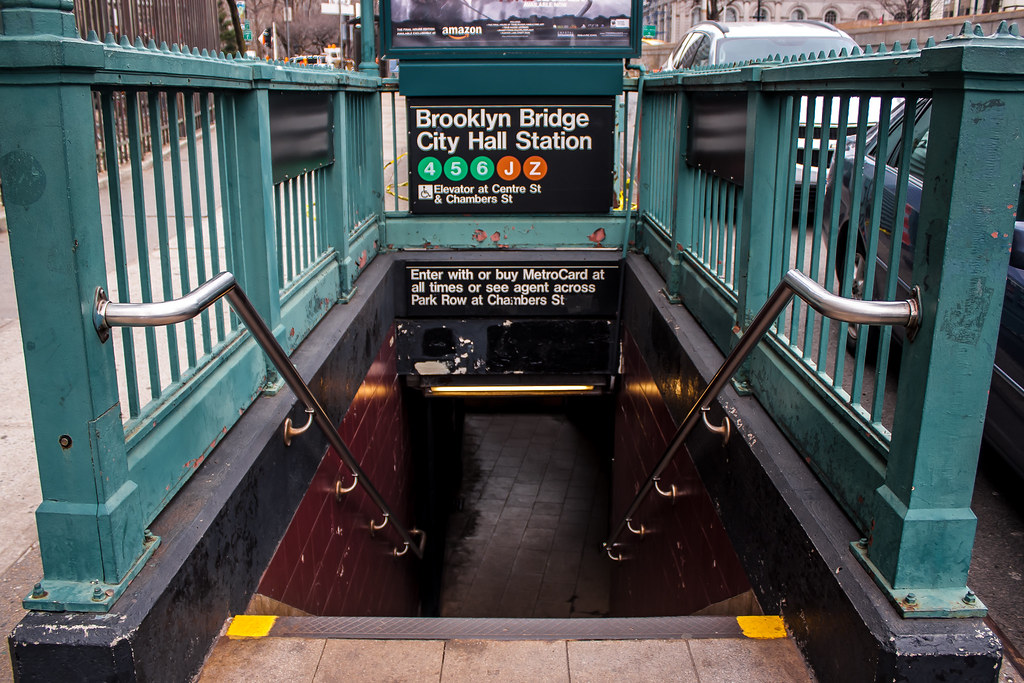
The NYC Subway is one of the world’s oldest and most extensive metro systems, with 472 stations and 27 lines. The routes are primarily identified by numbers or letters, and the trains operate 24/7. To ride, purchase a refillable MetroCard, available at vending machines in subway stations. Fares are a flat rate, so you can travel far in a single trip. Watch out for express trains that skip certain stops to provide quicker travel along the same line.
Understanding the Map
The NYC Subway map can initially seem overwhelming because of its complexity and the city’s size. Each line is represented by a color, but multiple lines can share the same color. The key is to understand that the color represents a trunk line running through Manhattan. For instance, the A, C, and E trains are all colored blue because they run along Eighth Avenue in Manhattan.
The map also differentiates between local and express routes. A black circle represents a local station where all trains stop, whereas a white circle with a black rim denotes an express station where only some trains stop.
Here, you can access the current NYC Subway Map.
Ticket System
In the NYC Subway, riders use the MetroCard, a rechargeable card that can be swiped at the turnstiles to pay for rides. Each ride costs $2.75 regardless of the distance traveled, making it relatively simple compared to systems that use zone or distance-based fares. You can also purchase a 7-day or 30-day unlimited ride MetroCard for multiple trips.
As of 2019, the MTA has started implementing a new fare payment system called OMNY (One Metro New York). This system allows contactless payment using credit, debit, or reloadable prepaid cards, and mobile wallets on smartphones or wearable devices.
Special Considerations
During peak hours, the NYC Subway can be quite crowded, and trains are often delayed. Always allow extra time for your journeys. It’s also crucial to pay attention to service changes, especially during weekends and late nights, when maintenance work is common.
Remember that in NYC, it’s customary to let passengers exit the train first before boarding, and you should always stand to the right on escalators, leaving the left side free for those in a hurry. As for safety, the NYC subway is generally safe, but always be mindful of your belongings, especially during rush hour.
London Underground
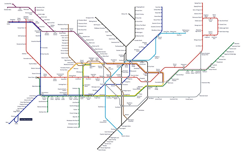
Known as the Tube, the London Underground is the world’s oldest metro system. It boasts 11 lines and 270 stations. The map, designed by Harry Beck, is a design classic, with each line represented by a different color. Tickets are available in the form of paper tickets, Oyster cards, and contactless payment cards. With Oyster cards, fares vary depending on how many zones you travel through. Mind the gap, a phrase you’ll often hear, which is a safety reminder about the space between the train and the platform.
Understanding the Map
The Tube map is renowned for its clear, color-coded, and geometric design. The individual subway lines are represented by distinct colors to help riders differentiate them. Each line zigzags across the map, with dots marking the stations. It’s important to note that the map is not to scale and doesn’t accurately represent the distances between stations.
Here, you can access the current London Subway Map.
Ticket System
The payment system for the London Underground uses the Oyster card and contactless payment cards. The Oyster card is a plastic smartcard that passengers can load with pay-as-you-go credit or Travelcard (unlimited travel for certain periods) to pay for rides. The price of a journey depends on how many zones you travel through.
The contactless system allows passengers to tap their debit or credit cards on the card reader. It’s important to tap in and out at the beginning and end of your journey to calculate the correct fare.
Special Considerations
The Tube is often crowded during rush hour, so it’s essential to plan your journey accordingly. The London Underground operates from 5:00 am to around midnight, but some lines offer a 24-hour Night Tube service on Fridays and Saturdays.
While navigating the Underground, remember to stand on the right when using escalators, leaving the left side for people in a hurry. Just like any major city, it’s crucial to be cautious of your belongings.
Paris Metro
he Paris Métro is famous for its Art Nouveau style entrances and its compact layout. With 16 lines and 302 stations, it’s one of the densest networks in the world. Tickets can be bought from machines at stations. You can buy single-journey tickets or a carnet, which is a book of ten tickets. The Navigo card, a contactless smart card, is another convenient option. Some entrances have traditional turnstiles, which require pushing the barriers to enter – so be prepared!
Understanding the Map
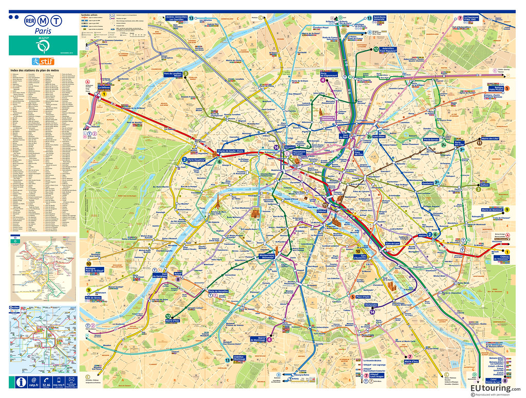
Paris Métro’s map is similar to most subway maps, with each line displayed in a different color. The lines intersect at numerous points, showing all the major interchange stations. The map may seem overwhelming initially due to its complexity, but once you understand the numbering and color system, navigation becomes much simpler.
Here, you can access the current Paris Subway Map.
Ticket System
The Paris Métro uses paper tickets, known as t+ tickets, which can be bought individually or in books of 10 (“carnet”). The tickets can be used on the Métro, RER (within Paris), buses, trams, and the Montmartre funicular. The Navigo Easy, a reusable contactless smart card, is also available. It can be loaded with t+ tickets, daily, or weekly unlimited travel passes.
Special Considerations
In Paris, note that subway service ends around 1:15 am on weekdays and around 2:15 am on weekends, resuming around 5:30 am. Most stations are close to one another, especially in central Paris. Ensure to validate your ticket before boarding a train and keep it until the end of your journey as ticket inspections are frequent.
While using the Paris Métro, be aware of pickpockets and keep your belongings close, especially during rush hour. It’s also customary to give up your seat to the elderly or pregnant women. Moreover, remember to let passengers off the train before boarding.
Tokyo Metro
The Tokyo Metro is one of the busiest in the world with 13 lines and over 290 stations. It’s recognized for its punctuality, cleanliness, and extensive network. Tickets can be purchased from vending machines in stations. The prepaid Pasmo or Suica card, which you can top up and tap at ticket gates, is the most convenient. English signage is ample, but the network is complex, so studying the map before travel is advised.
Understanding the Map
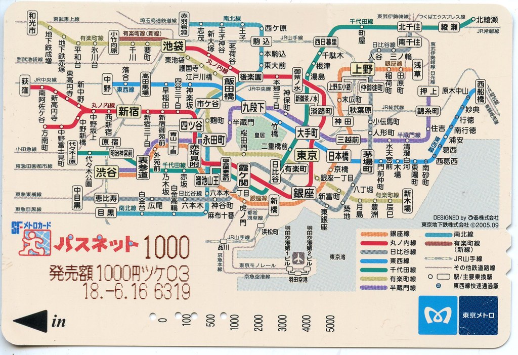
The subway map of Tokyo is a complex web of lines, each assigned a different color and letter. For Tokyo Metro, the lines are lettered from A to I and from N to G for Toei Subways. Despite its complexity, the map provides English translations, making it user-friendly for foreign travelers. The key is to know your departure and destination stations and follow the signs for the corresponding line.
Here, you can access the current Tokyo Metro Map.
Ticket System
Tokyo’s subway system uses paper tickets and prepaid cards, like PASMO and Suica. The fare is determined by the distance traveled, and tickets can be bought from vending machines at every station. Prepaid cards, which can be topped up at machines or convenience stores, are the most convenient way to pay for fares. You simply swipe the card at the entry and exit gates. These cards can also be used for purchases at affiliated retail outlets.
Special Considerations
In Tokyo, trains are punctual to the minute, so ensure you’re on time. During peak hours, the subway can get crowded, so be prepared. Certain cars during rush hour are designated as “Women Only”. Also, it’s considered impolite to talk on the phone or have loud conversations. Always stand on the left on escalators to let others pass on the right.
Lastly, many stations in Tokyo are enormous, with multiple exits leading to different parts of the district. Make sure you know which exit you need to take to avoid getting lost upon exiting the station. Stations often have English signage, but it’s handy to have a map or navigation app for assistance.
Berlin U-Bahn Lines
The Berlin U-Bahn (Untergrundbahn, meaning “Underground Railway”), marked by its yellow trains, is the backbone of Berlin’s public transport system. This bustling network has been serving Berlin since 1902 and effectively caters to a large part of the city’s public transportation needs.
The U-Bahn system operates along ten lines that span a total length of approximately 152 kilometers, reaching 173 stations. These lines are identified by the letters U followed by a number, such as U1, U2, etc, connecting key landmarks from the Berlin Wall to the Brandenburg Gate.
Known for its vibrantly decorated stations and open late-night services, the U-Bahn reflects Berlin’s unique history and the city’s around-the-clock energy.
Understanding the Map
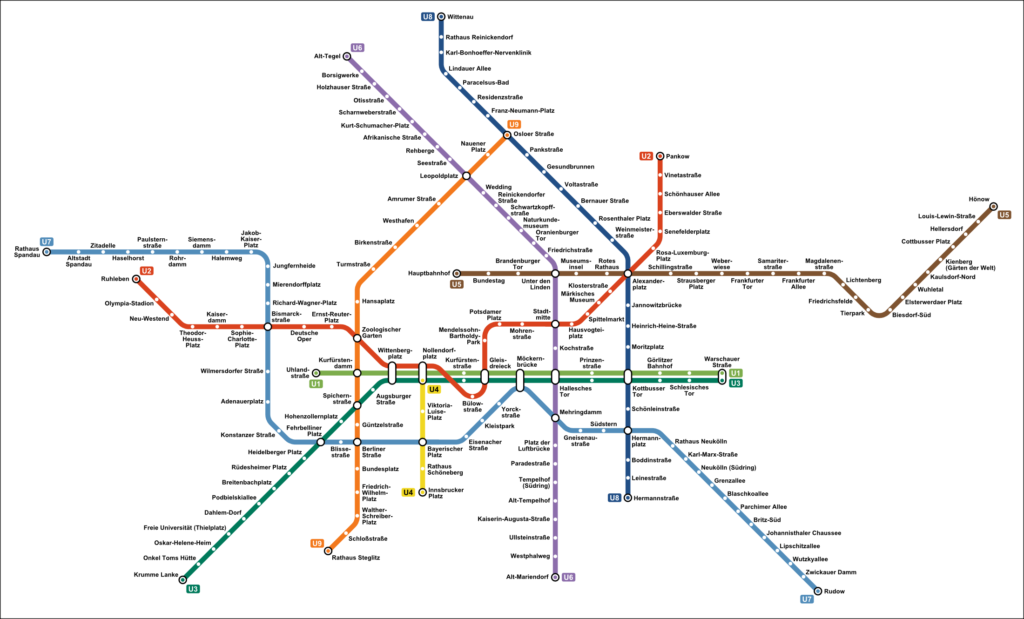
The U-Bahn’s network map is straightforward. Each line is represented by a distinct color, with transfer stations highlighted. The names of the end stations are usually indicated on the line itself, which helps users to understand the direction of the train.
You can find the network map here.
Ticket System
Berlin’s U-Bahn uses a proof-of-payment system, meaning you must validate your ticket before boarding. Tickets can be purchased at vending machines located at station entrances, on platforms, or in some buses and trams. The system is divided into fare zones A, B, and C. Make sure you buy a ticket that covers all the zones you need to travel through. There’s also a short trip ticket (Kurzstrecke) that is cheaper and valid for three stops on the U-Bahn.
Special Considerations
Berlin’s U-Bahn operates from approximately 4:00 am until 1:00 am on weekdays and 24 hours on weekends. Please be aware that while the U-Bahn is generally safe, pickpocketing can occur, so keep an eye on your belongings. Also, remember that drinking alcohol on Berlin’s public transport is forbidden.
Beijing Subway
The Beijing Subway is the busiest and second-longest subway system in the world, with 23 lines and more than 400 stations. For payment, Yikatong, a rechargeable transportation card, is widely used. You can also pay with your smartphone. The fare depends on how far you travel. English signage is comprehensive, making navigation relatively straightforward. Be prepared for high security, with bag checks at all stations.
Understanding the Map
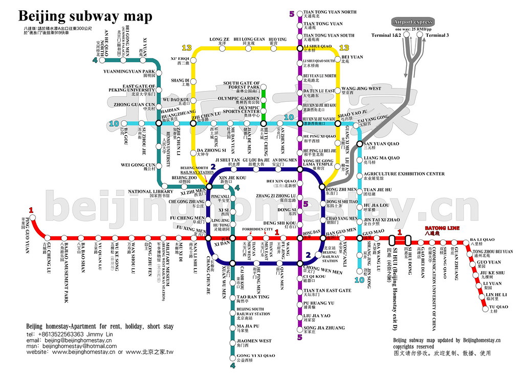
The Beijing Subway map uses different colors to distinguish each line, with the line’s number and terminal stations indicated. Each station is marked, and interchange stations are highlighted. Familiarizing yourself with key landmarks and areas can make it easier to navigate the system.
The current map is available here.
Ticket System
Beijing Subway operates a distance-based fare system. Tickets can be bought at automated vending machines available at all subway stations. These machines can change languages to English, which makes it easier for foreign passengers. There’s also an option of using a transportation card, “Yikatong”, that can be topped up with desired amounts for more comfortable travel.
Special Considerations
The Beijing Subway is usually open from 5:00 am to 11:00 pm, but operating times can vary slightly depending on the line. Peak hours can get exceptionally crowded, so if possible, plan your travel outside these times. Security is tight on the Beijing Subway, with baggage scans at all stations, so allow a little extra time for this. Lastly, English signage is available, but having a translation app could be useful.
Seoul Metropolitan Subway
One of the most heavily used subway systems in the world, the Seoul Subway features 21 lines and more than 300 stations. Tickets can be bought from machines or ticket offices. The T-Money card, a rechargeable smart card, can be used on buses and taxis as well. Most lines operate from 5:30 am to midnight. Many signs and station announcements are in English, but having a subway map app on your smartphone could be handy.
Understanding the Map
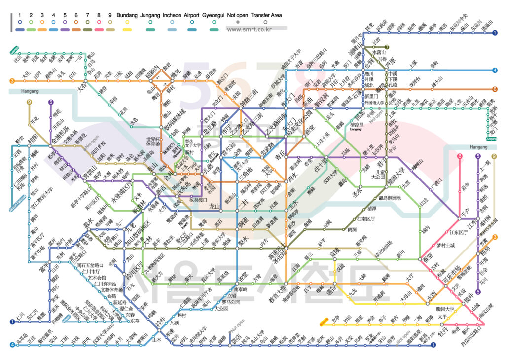
Seoul Subway’s map is color-coded, with each line represented by a different color, making it easy to distinguish lines at a glance. It’s a vast network, so understanding the main lines first and knowing the direction of your destination will simplify your journey.
The subway map can be accessed here.
Ticket System
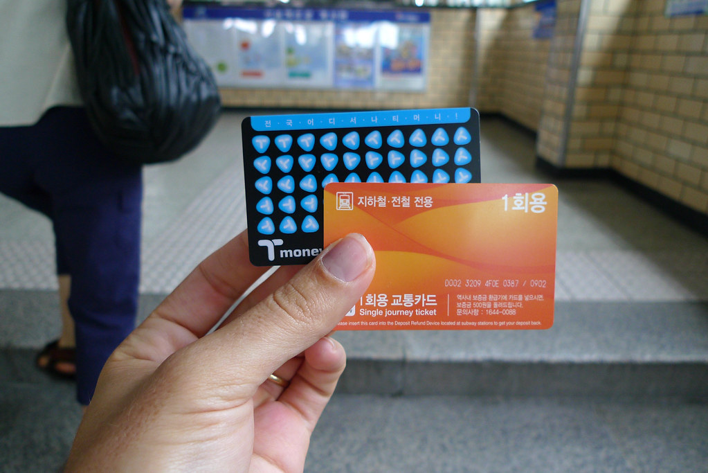
Tickets can be bought from ticket vending and card reload devices available in subway stations. Passengers can opt for Single Journey Tickets or a rechargeable T-Money Card. For frequent travelers, the T-Money Card offers the convenience of not having to buy a ticket each time and fare discounts.
Special Considerations
The subway operates from approximately 5:30 am to midnight. During peak hours, trains run every 2-3 minutes, ensuring minimal wait times. Announcements and signage in the subway are bilingual (Korean and English), and some also include Japanese and Chinese. Additionally, free WiFi is available at all stations, allowing for seamless connectivity.
Frequently Asked Questions About Subway Lines
Which subway line is the fastest?
The Shanghai Maglev Train holds the record for the fastest commercial high-speed maglev service in operation, reaching speeds up to 430 km/h (267 mph). This train operates in Shanghai, China, between Pudong International Airport and the outskirts of central Pudong, Shanghai.

